 Global
Earth Science Data Interface (ESDI) at the Global Land Cover Facility
The Earth Science Data Interface is the GLCF's web application for searching, browsing, and downloading data from our online holdings. Inland surface water bodies-including fresh and saline lakes, rivers, and reservoirs- cover only a small portion of the Earth's surface, but they are essential to terrestrial ecosystems and human civilization.
Simple
- Date (Révision)
- 2018-03-15
- Contact pour la ressource
-
Nom de l'organisation Nom de la personne Adresse e-mail Rôle Point de contact
- Fréquence de mise à jour
- Lorsque nécessaire
-
IWRM Country Basin
-
-
World
-
-
IWRM themes
-
-
Environmental context
-
- Contraintes d'accès
- Droit d’auteur / Droit moral (copyright)
- Contraintes d'utilisation
- Autres restrictions
- Type de représentation spatiale
- Vecteur
- Langue de la ressource
- English
- Encodage des caractères
- Utf8
- Catégorie ISO
-
- Eaux intérieures, Hydrographie
N
S
E
W
))
- Nom du système de référence
- WGS 1984
- Ressource en ligne
-
Protocole Adresse Internet Nom WWW:LINK-1.0-http--link
http://glcfapp.glcf.umd.edu:8080/esdi/index.jsp ESDI
- Niveau
- Application
Métadonnées
- Identifiant de la fiche
- b53e45cd-2c34-43e0-844a-7bb96e32796d XML
- Langue
- English
- Jeu de caractères
- Utf8
- Type de ressource
- Application
- Date des métadonnées
- 2018-03-27T09:34:39
- Nom du standard de métadonnées
-
ISO 19115:2003/19139
- Version du standard de métadonnées
-
1.0
- Contact
-
Nom de l'organisation Nom de la personne Adresse e-mail Rôle Point de contact
Aperçus
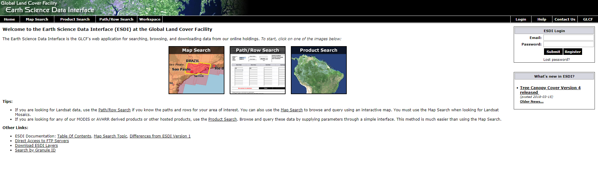
ESDI.PNG
Étendue spatiale
N
S
E
W
Fourni par
Ressources associées
Not available