Catalogue EECCA
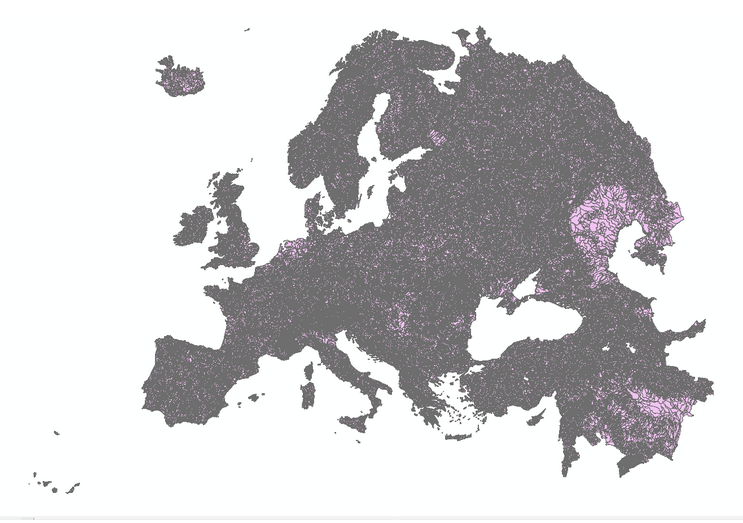
European catchments and Rivers network system (Ecrins)
Ecrins - European catchments and Rivers network system. It is a geographical information system of the European hydrographical systems with a full topological information. Ecrins is a composite system made from the CCM developed by the JRC, Corine land Cover, WFD reporting elements, etc. Catchments are grouped as sub-basins, river basin districts. Catchments are drained by 1,348,163 river segments, sorted as “main drains” (connecting together the FECs) and secondary drains (internal to a FEC). River segments mimic the natural drainage, however fulfilling the topological constraint of “0,1 or 2 upstreams, single or 0 downstream”.
Simple
- Date (Publication)
- 2012-06-13T16:04:00
- Contact pour la ressource
-
Nom de l'organisation Nom de la personne Adresse e-mail Rôle Europrean Environment Agency
Auteur
-
IWRM Country Basin
-
-
Armenia
-
Azerbaijan
-
Belarus
-
Georgia
-
Moldova
-
Ukraine
-
Kazakhstan
-
-
IWRM themes
-
-
Surface water
-
- Contraintes d'accès
- Droit d’auteur / Droit moral (copyright)
- Contraintes d'utilisation
- Droit d’auteur / Droit moral (copyright)
- Type de représentation spatiale
- Vecteur
- Dénominateur de l'échelle
- 200000
- Catégorie ISO
-
- Eaux intérieures, Hydrographie
))
- Format (encodage)
-
Nom Version Shape
EPSG:3035
- Ressource en ligne
-
Protocole Adresse Internet Nom WWW:LINK-1.0-http--link
https://www.eea.europa.eu/data-and-maps/data/european-catchments-and-rivers-network#tab-figures-produced EEA - Ecrins
- Niveau
- Jeu de données
Métadonnées
- Identifiant de la fiche
- 40325669-20d0-4286-b4a3-038d50236183 XML
- Langue
-
eng
- Jeu de caractères
- Utf8
- Date des métadonnées
- 2018-05-09T14:15:55
- Nom du standard de métadonnées
-
ISO 19115:2003/19139
- Version du standard de métadonnées
-
1.0
- Contact
-
Nom de l'organisation Nom de la personne Adresse e-mail Rôle Europrean Environment Agency
Auteur
- Autre langue
-
LanguageCode CharacterEncoding Russian English Utf8